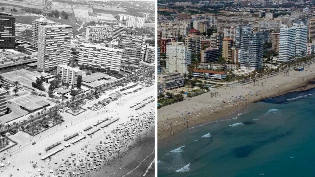
Almost a century ago, in the 1930s, the neighborhood of Playa de San Juan was born with the dream of turning that area into Alicante in a “vacation town”. Since that moment, a series of projects and urban modifications have taken place that, 90 years later, have resulted in what is currently one of the most populated areas of the capital of the province. All this transformation is now captured in a book published by the University of Alicante that reviews how that area became what it is today.
The work has been edited by the journalist José María Perea; the professor of the Urban Planning department at the Polytechnic University of Valencia Francisco Juan Martínez; and the professor of Urban Planning at the University of Alicante José Ramón Navarro Vera. It includes the interventions of a series of conferences promoted by the Democracy Archive of the University of Alicante, which took place in Alicante on the occasion of the 90th anniversary of the approval of the so-called “Prieto Law”, promoted by Indalecio Prieto, Minister of Public Works of the Government of the Second Republic, with the aim of planning a holiday city in said environment.
At that time, Not only was the project approved to promote tourism in the area (known as the Muguruza Plan, after the architect who wrote it, Pedro Muguruza), but also the first highway that linked the neighborhood with the city center was planned. In addition, the Cortes approved the expropriation and development plan for Playa de San Juan.
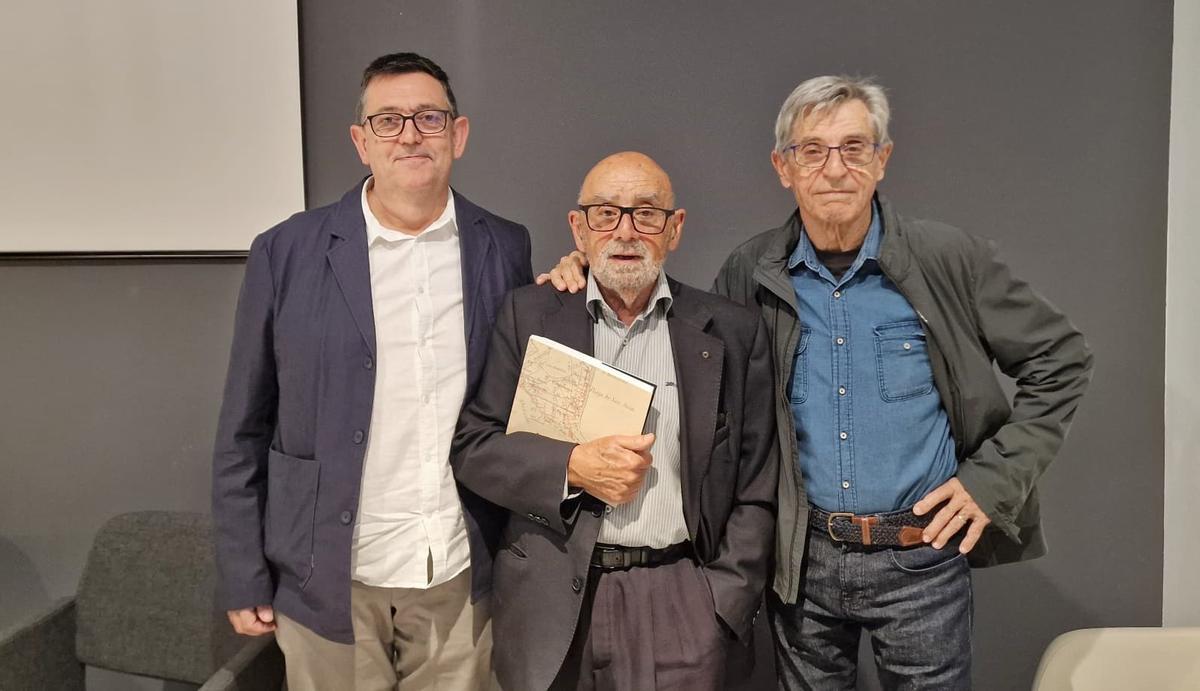
From left to right, the professor of the Department of Urban Planning of the Polytechnic University of Valencia Francisco Juan Martínez, the journalist José María Perea and the professor of Urban Planning of the University of Alicante José Ramón Navarro. / Rafa Arjones
It was a very modern bet for the time due to its broad metropolitan vision.
Subsequently, this project was distorted after the Civil War, replaced by others, among which some still included determinations of the original project, until In the sixties the area became a benchmark for sun and beach vacation tourism, with all its urban and architectural implications. At the beginning of the 21st century, the sector became a space where the determining factors of new forms of residential land production and urban life converged.
A historic development
José María Perea He highlighted that the book tells what Alicante was like in the 1930s, when the development of Playa de San Juan was approved along with the project to promote tourism in the area, the first road that connected with the city center and the planned roadmap for the growth of the neighborhood.
A bet that, according to Perea, was “very modern for the time” due to its broad “metropolitan vision”, that connected with El Campello and Muchavista beach, as well as for its complementary offer oriented towards tourism: which included the projection of sports areas, such as the golf course.
It is a book that was needed in the city, it is very rich in terms of graphics and content.
In the same line, Francisco Juan Martínez has pointed out that the book was born from the conferences organized by the Archive of Democracy, which provided “a very complementary vision” thanks to the participation of all types of professionals. The work, as explained, is structured in four blocks: one history of contextualization, a second focused on the turismothe third on the plans and projects that have affected the area; and a last section on the current reality. “It is a book that was needed in the city, it adds wonderful color illustrations and original plans collected from the archives, it is very rich in terms of graphics and content,” says Martínez.
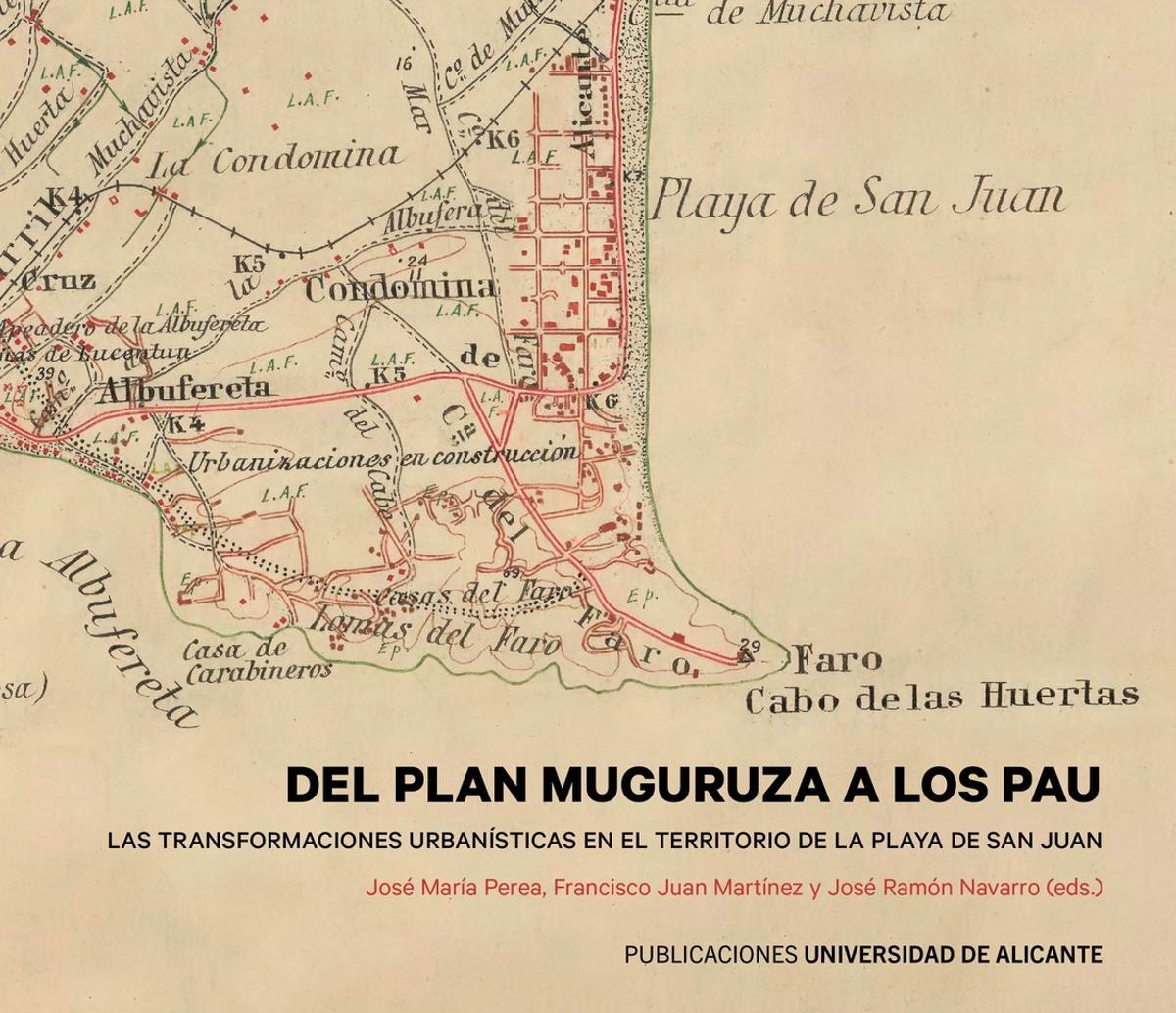
The cover of the book “From the Muguruza plan to the PAU”, about the development of Playa de San Juan. / INFORMATION
For its part, José Ramón Navarro Vera has provided an urban vision of the last decades, focused on the planning of the area and with a focus on the PAU. “These areas emerged as unscheduled developable land in the mid-70s as a space without short-term expectations for its development,” he comments. In Alicante, these spaces They were organized following a linear model along the Vía Parque and the Gran Víafrom the area around Puente Rojo (PAU 1 and 2), to Albufereta, Condomina and Cabo de la Huerta (PAU 3 and 4) and Playa de San Juan (PAU 5).
These areas emerged as unscheduled developable land in the mid-70s as a space without short-term expectations for its development.
The professor of Urban Planning has also highlighted that These PAU estimated, according to the General Urban Planning Plan of 1987, a total of more than 20,000 homesalmost half of the total planned for the city. Of that figure, in addition, Playa de San Juan represented almost 19,000 of the total properties, which denotes the weight that the expansion of the area has had on the urban growth of the provincial capital.
All of this was exhibited this Wednesday at the Territorial College of Architects of Alicante, within the framework of the TAC Festival!, with the presentation of the book “From the Muguruza Plan to the PAU, Urban transformations in the territory of San Juan beach”, in an event attended by the three editors of the work. A publication that also includes contributions from Justo Oliva, Andrés Martínez, Santiago Varela, Carmen Blasco, Jorge Olcina and Tomás Mazón, among other authors.
Subscribe to continue reading