Torrid night In the province of Alicante and forecast of More heat and storms, with hail and wind. They are the consequences of saharian air pulsations, the temperature of the sea and cold air that remains in high layers.
After a week with nights Tropical On the coast, above 20 degrees of minimum, the early hours of Monday has left Unusual records. And we have not yet entered the astronomical summer, which begins until June 21, although we are already fully in the weather. And the situation will continue, although it will also be accompanied by risk of storms due to cold air remains in high layers this Tuesday and Wednesday.
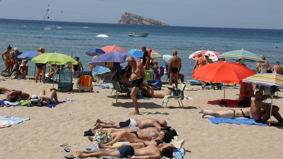
Thus, the night has been very hot, especially on the coast, according to the State Meteorology Agency (Aemet) in the Valencian Community. According to the data of the Avamet Observatories Network, the palm has been taken by Benidorm, where mercury has not dropped from 27 degrees. They have followed Altea with 25.9, Alicante and Santa Pola with 25.8, El Campello with 25.4 and Crevillent, Finestrat, Tabarca and Elche (Torrellano) with 25.1.
Anyway, Aemet has just activated meteorological alerts for storms for Tuesday, Between 2:00 p.m. and 10:00 p.m.. And el North Coast -Obre everything in the inside- E North Interiorhay Orange alert for large hail, very strong winds, and yellow by rains that can reach up to 20 liters in an hour. And the rest of the province -SoSo Sur- there are Yellow alert for hail, very strong winds and rains up to 20 liters per square meter in an hour.
And for him Wednesday There is yellow alert inside north, by rains, from 2:00 p.m. to 10:00 p.m.
On the torrid nights and high temperatures that we have been in recent days, the director of the UA Climatology Laboratory, Jorge Olcinaexplained that “we enter a Heat sequence that will take us to the whole week and even until the end of June“.
He recalled that “the trends of recent years are maintained, that we have every time we have less comfortable night heatthese temperatures are accumulating, also related to the heat that is accumulating in sea water “, which already exceeds 25 degrees. A sequence that will continue in the next few days, with” practically already full conditions, although we are in the last days of astronomical spring. “
Saharian air pulsations
And it is that the professor of regional geographical analysis has pointed out that “they will enter the Saharan air pulsations. The first is already receiving it these days. And they will be happening, so that We enter summer modewith very high temperatures. “
Of course, he pointed out that on Sunday there were storms that can continue especially inside, when remains of cold air in high layers and like This type of chaparrons is formed so much on the surface. That is why there is the risk of these bursts by accumulating a lot of heat on the surface and colliding with a small cold air tongue that remains in high layers.
A embarrassment in the first half of June with a single precedent
From Aemet they have stood out on Monday that the first half of June has had an average temperature in the Valencian Community 3.2 degrees higher than the normal average. There is only one precedent of a first June fortnight as warm as that of 2025 and it happened in June 2022.
And the forecast is that we continue with a similar panorama, with anomalous heat, full summer, very high night temperatures and storms in the afternoon Inside, in this second half of June, according to Aemet.
Subscribe to continue reading