The wave of fires that ravages Spain in August is still active and is primed especially with the province of Ourense. The official count of the Xunta this Saturday is that 10 fires continue in the province that already razes 42,000 hectares, where evacuations, confinements and several injured have been recorded. The impact of the flames that can be seen from space anticipates a devastating balance in the forest areas of the province.
Through the images of the satellites of the European Copernicus program, we can reconstruct the rapid sequence of the great fires that have calcined thousands of hectares this August in the Galician province.
The largest fire – until now – is declared in Chandrexa de Queixa, which already exceeds 20,000 hectares razed, according to the latest estimates based on satellite images. Still without controlling, several foci of fire remained active today, as shown by the photographs collected by the Copernicus system.
More than 20,000 hectares burned in Ourense
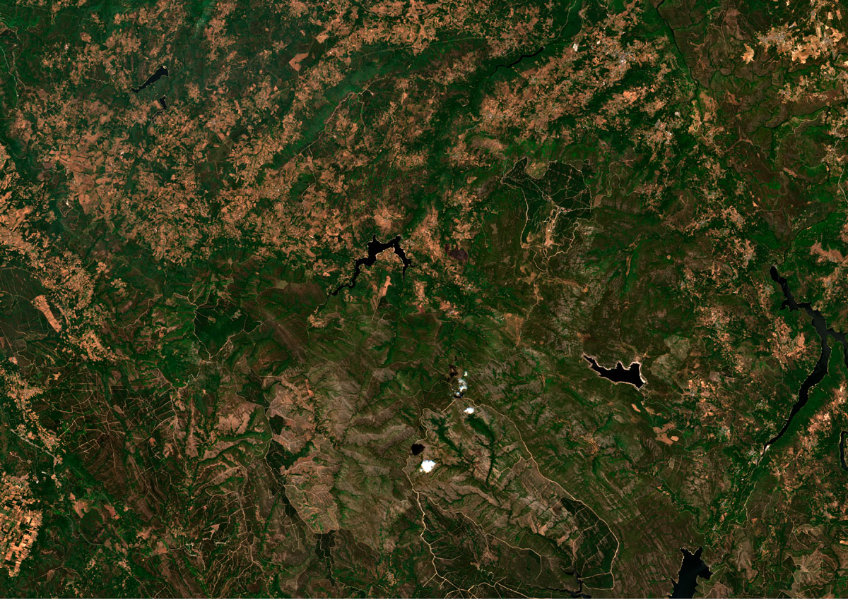
Fuente: Copernicus
Until Thursday, the flames of the four major fires that have ravaged the Galician province swept at least 39,000 hectares, according to the last estimate of the European Forest Fire Information System (EFFIS).
Although the data is still provisional since EFFIS estimates calculate the burned areas from the perimeter of the fire and may include within these limits areas that have been saved from the flames, the most recent satellite images of the fires indicate that the first calculations could fall very short.
Oimbra's, which began in the parish of A Granxa and also affects Monterrei, which, Verín and Laza, amounts to 10,500 hectares, according to the Xunta de Galicia. In this fire, three workers of the Municipal Brigade were seriously injured.
The fire, still active, caused the evacuation of residents of some nuclei of Monterrei. Satellite images show the rapid expansion and widely fully covered areas that could be seen today from space.
More than 10,000 hectares calcined in this fire
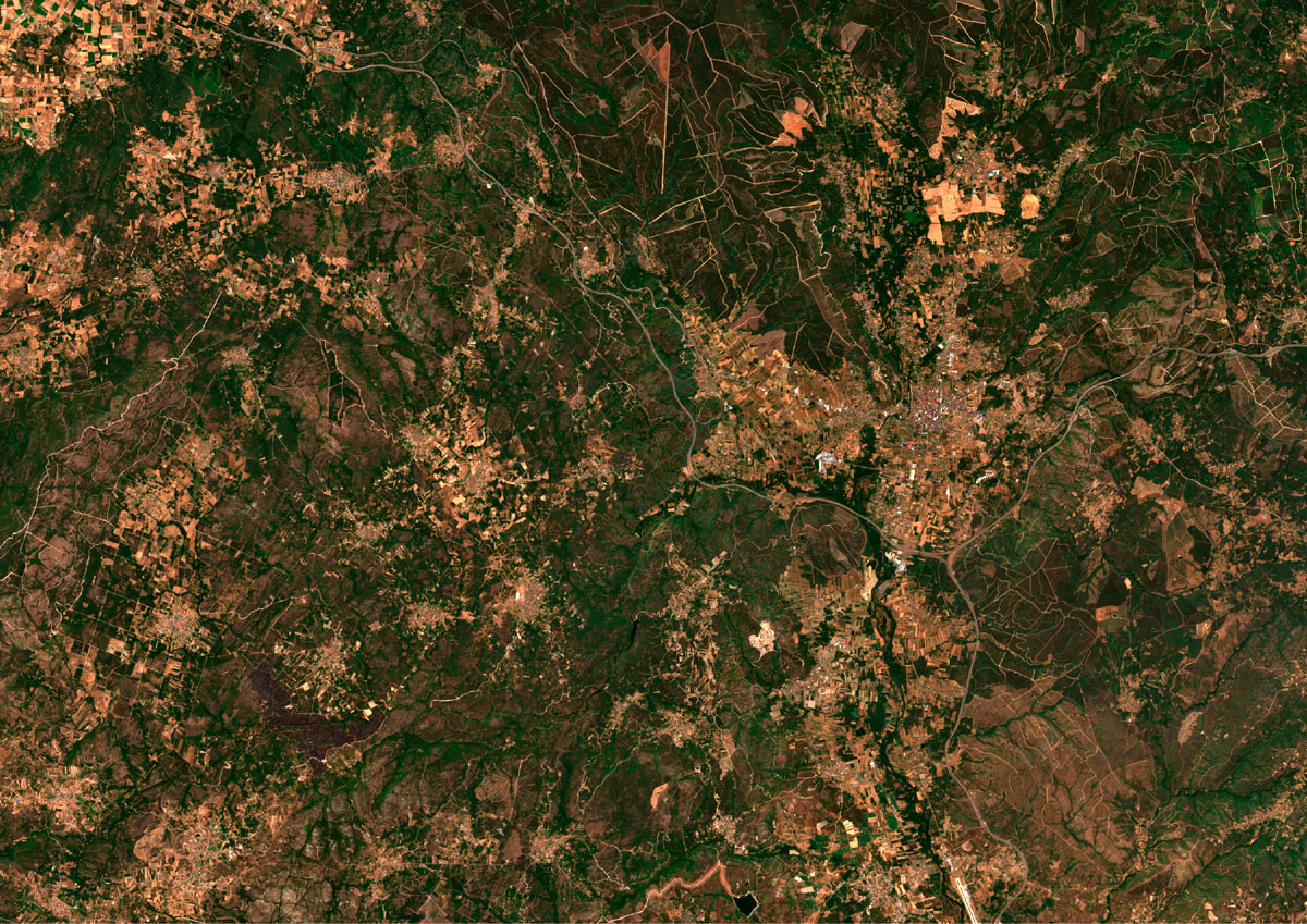
Fuente: Copernicus
Another of the most worrying spotlights is that of the Fire of A Mezquita, which exceeds 5,000 hectares and remains active in the province of Ourense. The fire that began in Mosquita, which extended towards Gudiña and border territories of the province of Zamora, has 9,000 burned hectares. The last images captured by the satellite show the smoke columns that swept everything in their path.
More than 9,000 hectares calcined in this fire
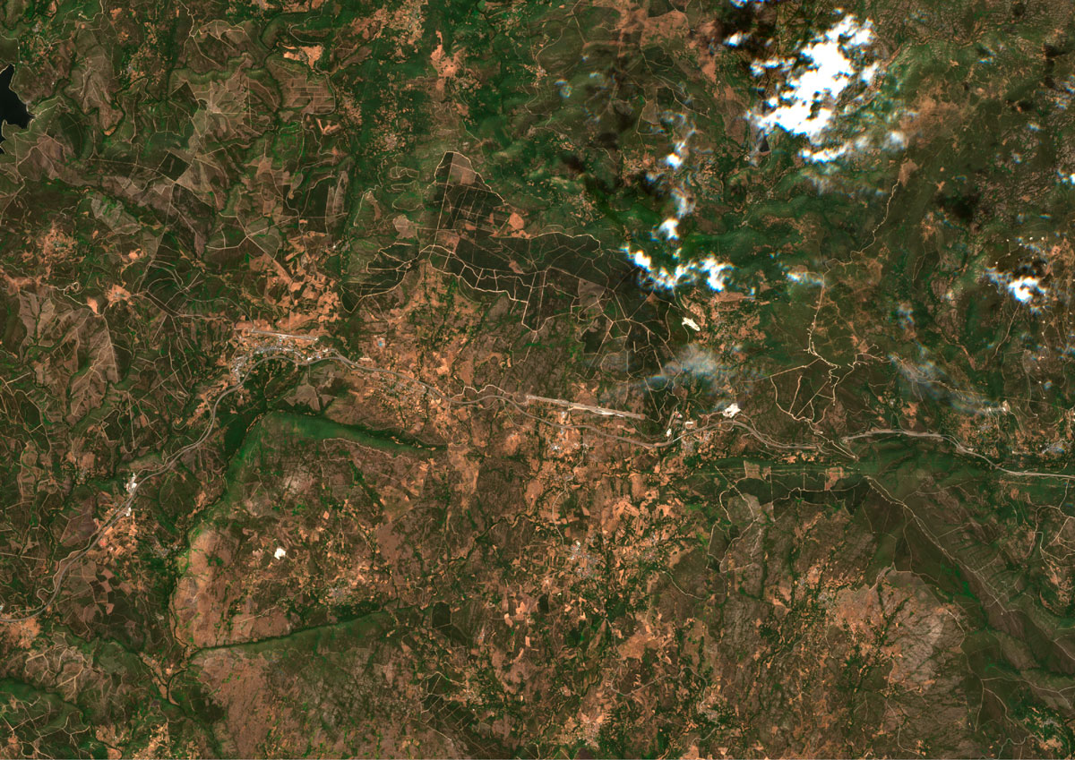
Fuente: Copernicus
The situation remains without control and the device is overwhelmed, as recognized by Xunta.
In addition, fires in Ourense coincide with the warmest year in their history. Temperatures from the beginning of August, when the fires began, do not fall from 35º degrees in the Galician province. In what we have of 2025, 55 temperature records have been beaten, 16 of them in provincial capitals, according to Eldiario.es calculations.